
Pre-Engineering Survey
Pre-Engineering Survey
We provide precise, high-resolution mapping of the seabed’s depth and contours using advanced multibeam echosounders. Whether you’re planning pipelines, cables, or offshore platforms, our detailed 3D maps give you the clarity to design with confidence, ensuring safety and efficiency.
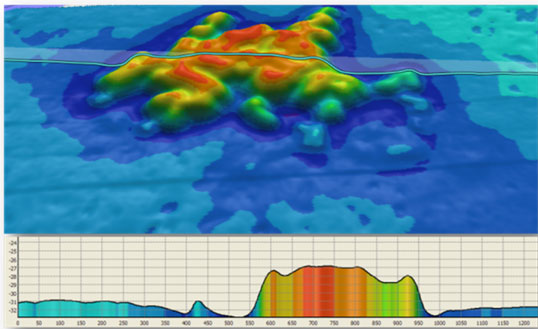
Seabed bathymetry and topography
We provide precise, high-resolution mapping of the seabed’s depth and contours using advanced multibeam echosounders. Whether you’re planning pipelines, cables, or offshore platforms, our detailed 3D maps give you the clarity to design with confidence, ensuring safety and efficiency.
Seabed features and obstructions
Our Seabed Features and Obstructions Survey identifies every detail—from boulders and wrecks to unstable slopes—sonar technology. We map critical features and potential hazards, empowering you to plan the safest routes for pipelines, cables, or offshore installations. Protect your project and the environment with our expert insights.
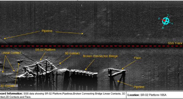
Seabed features and obstructions
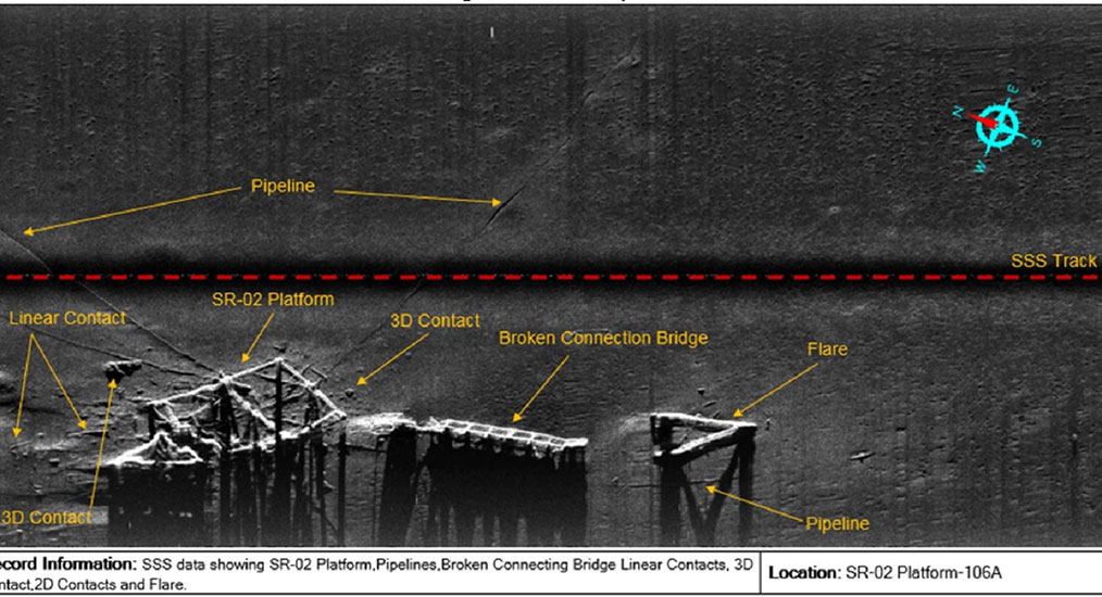
Our Seabed Features and Obstructions Survey identifies every detail—from boulders and wrecks to unstable slopes—sonar technology. We map critical features and potential hazards, empowering you to plan the safest routes for pipelines, cables, or offshore installations. Protect your project and the environment with our expert insights.
Sub-bottom Data Extract
Using advanced geophysical techniques like seismic reflection and sub-bottom profiling, we uncover sediment layers, geological structures, and hidden hazards like gas pockets or faults. Perfect for pipelines, cables, or offshore projects, our detailed subsurface data ensures safer planning and installation.
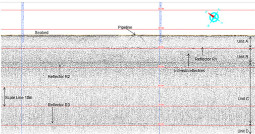
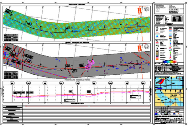
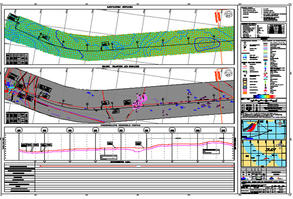
Pre-Engineering Alignment Sheet
We deliver a comprehensive roadmap, combining bathymetry, seabed features, and sub-bottom data into a clear, actionable plan. Whether it’s for pipelines, cables, or offshore installations, our alignment sheets help you visualize the ideal route, avoid obstacles, and ensure compliance with safety and environmental standards.